


By clicking “Accept All Cookies”, you agree to the storing of cookies on your device to enhance site navigation, analyze site usage, and assist in our marketing efforts Cookies Policy.
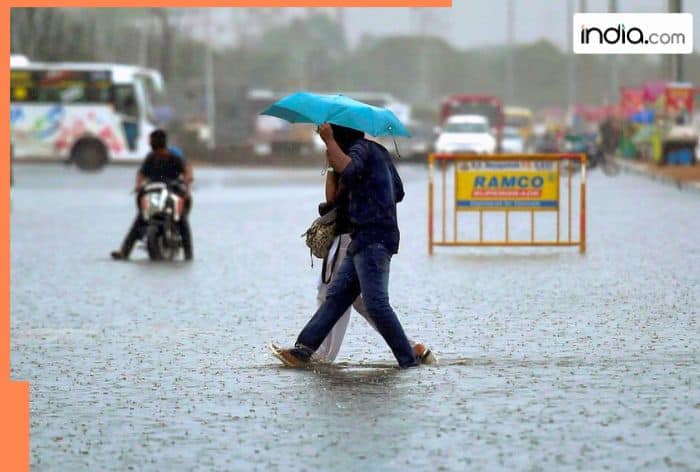
Chennai: In a recent weather update, the Regional Meteorological Centre (RMC) have predicted heavy rainfall in four Delta districts of Tamil Nadu including, Cuddalore, Mayiladuthurai, Nagapattinam, and Tiruvarur for December 17 and 18 due to the northeast monsoon. Meanwhile, Karaikal is also predicted to receive very heavy rainfall during this period. This is due to the formation of a new low pressure area over the southeast Bay of Bengal. As per the weather department, this low pressure system is forming under the influence of an upper-air cyclonic circulation, located over the South Andaman Sea and adjoining areas before moving forward to the Bay of Bengal.
The rains are due to a new low-pressure area over the southeast Bay of Bengal. According to the weather department, this low-pressure system is forming under the influence of an upper-air cyclonic circulation, which was located over the South Andaman Sea and adjoining areas before moving toward the Bay of Bengal. However, this system is anticipated to become more evident and move towards the Tamil Nadu coast during the day.
Isolated places like Chengalpattu, Villupuram, Kallakurichi, Ariyalur, Perambalur, Tiruchy, Thanjavur, Pudukkottai districts, and Puducherry are likely to receive heavy rain during this period. While on December 18, areas like Tiruvallur, Chennai, Chengalpattu, Kancheepuram, Ranipet, Tiruvannamalai, Kallakurichi, Mayiladuthurai, Nagapattinam, Tiruvarur districts, including Karaikal, Cuddalore, Villupuram districts, and Puducherry are expected to receive heavy to very heavy rainfall.
According to the information by a MeT official, any stall or slow movement of the weather system could turn the rainfall event into widespread heavy rainfall in northern Tamil Nadu. In addition to that, the interaction of westerly and easterly winds near south-coastal Andhra Pradesh and north-coastal Tamil Nadu are intensifying, raising the likelihood of extreme rainfall between Marakkanam and Sriharikota. The areas between Pondicherry and Nellore may also experience heavy to very heavy rain during this period.
The Fishermen have been advised not to venture into the sea and those currently at sea have been instructed to return to shore immediately.
Notably, Tamil Nadu has so far recorded 14 per cent excess rainfall during the ongoing monsoon season, with 447 mm received compared to the seasonal average of 393 mm. Chennai received 845 mm rainfall, marking a 16 per cent rise from the average, while Coimbatore witnessed a significant 47 per cent increase in rainfall.
This warning follows the devastation caused by Cyclone Fengal, which impacted Tamil Nadu and Puducherry from November 29 to December 1. The cyclone brought intense rainfall, followed by heavy downpours caused by a low-pressure area over the southern Bay of Bengal. It caused significant damage, resulting in 12 fatalities and inundated 2,11,139 hectares of farmlands, affecting both agricultural and horticultural crops. Infrastructure damages included 1,649 km of electric conductors, 23,664 electric poles, 997 transformers, 9,576 km of roads, 1,847 culverts, and 417 water tanks. Several houses and huts were also damaged, with areas like Villupuram, Tiruvannamalai, and Kallakurichi districts receiving over 50 cm of rainfall in a single day, which was equivalent to the average for an entire season. This further caused severe flooding and widespread crop damage. According to the Tamil Nadu government, about 69 lakh families and 1.5 crore individuals were affected by the disaster.
(IANS inputs)
For breaking news and live news updates, like us on Facebook or follow us on Twitter and Instagram. Read more on Latest India News on India.com.